Geography
Natural Frontiers
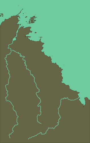
The Goelo is a coastal region of the Atlantic sea delimited by three rivers roughly forming a rectangular shape, with a length of 40 kilometers that extend 10 kilometers inland, for a total area of 530 square kilometers.
The Trieux river in the north and the Gouet in the south reach the sea, while the Leff forming the east side of the region ends its course in the Trieux.
The southeast of the region is more elevated, with some hills reaching 250 meters, due to the presence of the Quintin massif where the sources of the three rivers are located.
Administrative Limits
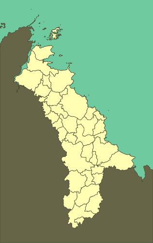
The region can also be defined by the administrative limits of 38 communes: Binic, Cohiniac, Étables-sur-Mer, Île-de-Bréhat, Kerfot, La Méaugon, Lanleff, Lanloup, Lannebert, Lantic, Lanvollon, Le Fœil, Paimpol, Plaine-Haute, Pléguien, Pléhédel, Plélo, Plérin, Plerneuf, Ploubazlanec, Plouézec, Plouha, Plourhan, Plourivo, Plouvara, Pludual, Pordic, Quintin, Saint-Donan, Saint-Quay-Portrieux, Trégomeur, Tréguidel, Tréméloir, Tréméven, Trémuson, Tressignaux, Tréveneuc, Yvias.
Location
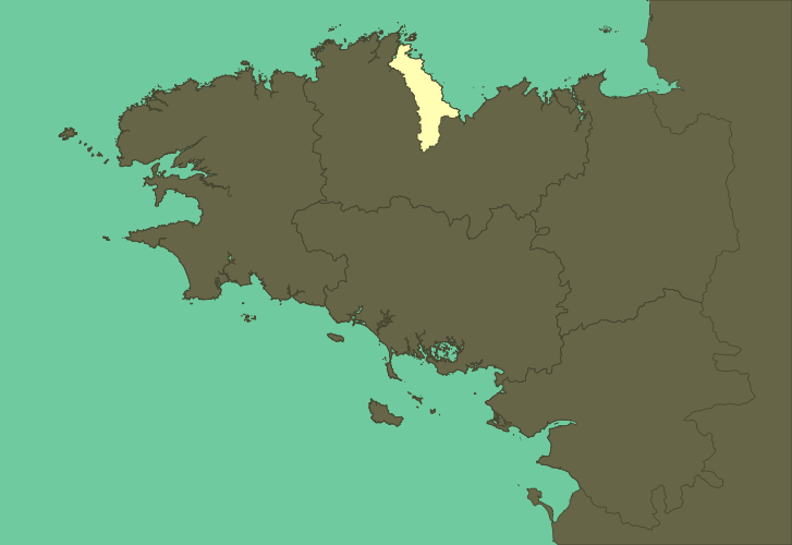
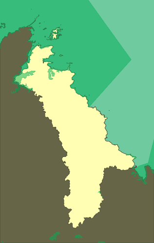
The communes are all part of Saint-Brieuc arrondissement, located in Côtes d'Armor, a department in the north of Brittany.
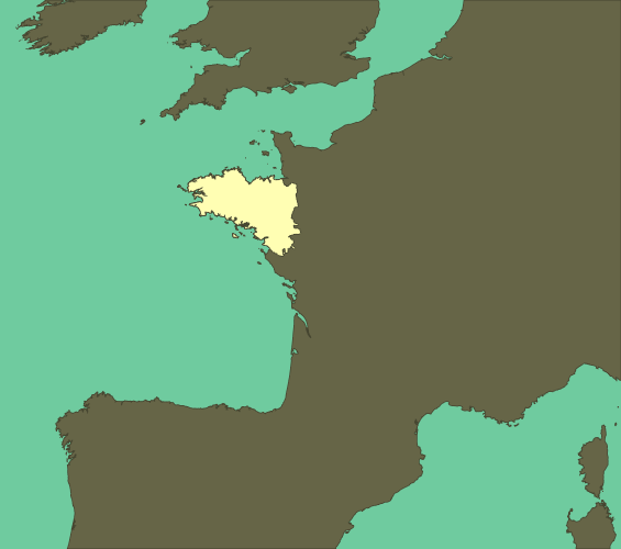
And Brittany is situated in the northwest of France, at the center of the biogeographical region Atlantic Europe.
Climatology
Temperature
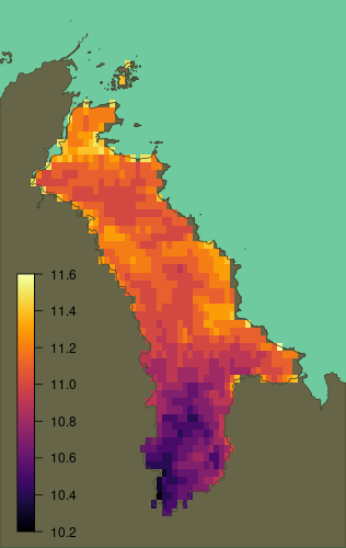
The annual mean temperature of Goelo is 11.0 °C (WorldClim 2005).
The minimum temperature of the coldest month is 2.7 °C and the maximum temperature of the warmest month is 20.8 °C.
The north is usually about a degree warmer than the south.
Precipitation
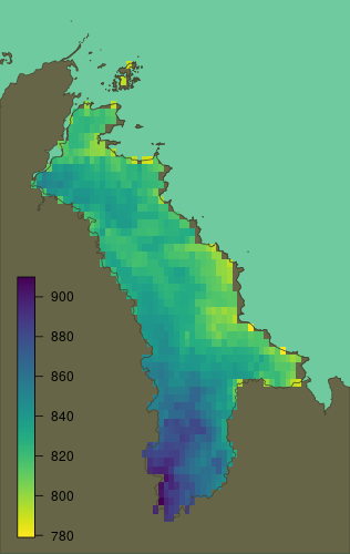
The region receives in average 835 mm of precipitation every year (WorldClim 2005).
In average the driest and wettest months receive 42 and 102 mm of precipitation respectively.
Demography
Population
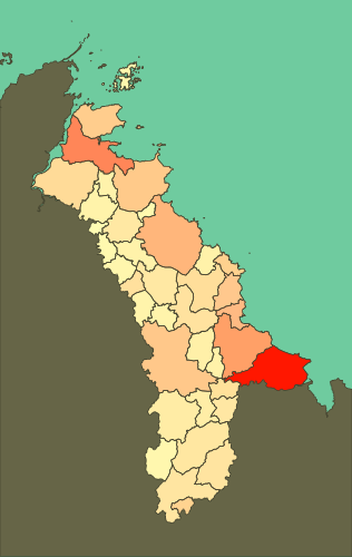
The Goelo has 82 582 inhabitants (INSEE 2013), and a population density of 156 per square kilometers.
The largest towns, Plérin (14394 habitants), Paimpol (7298), Pordic (6088), Plouha (4505), and Binic (3825) are all situated on the coast.
The population density decrease inland, with small villages like Lanloup (264), and Lanleff (111) surrounded by farms.
Ecology
Land Usage
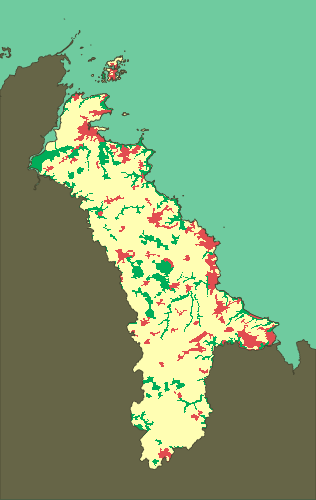
According to CORINE Land Cover inventory (CLC 2012), most of the land is used by agriculture (76 %), with the rest divided between artificial (13 %) and forest or semi natural areas (11 %).
Tree Cover
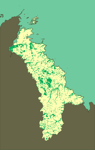
About 20% of the land is covered with trees (Hansen 2014), but there are only a few forests, and most of them are privately owned and used for silviculture.
The largest forests are Penhoat-Lancerf (600 ha) and Beauport (90 ha) in the north with smaller woods like Beauchamp and Salle in the middle of the region.
Conservation
3.15 % of the land is protected under the Natura 2000 network.
2.45 % and 4.36 % are respectively classified as ZNIEFF type I and type II zones of outstanding natural areas of ecological interest.